
Artsakh Through the Eyes of a Cypriot (Part Two)
Refresh your memory from the first part of George’s travels and read about his trip to Armenia here.
Artsakh captured my imagination ever since I was unable to find it on a map. While researching for my dissertation on Turkey’s European Union accession, I downloaded a podcast by the former Turkish Foreign Minister Abdullah Gül who spoke at length about Turkey’s stance on Nagorno-Karabakh. Where was this place called NKR that sounded like a radio station?
I opened an atlas at the university’s library and found no such place. I looked in yet another atlas. Still nothing.Not only could I not find Artsakh on a map, I couldn’t find it on an app. A simple Google search shows regions like the Crimea with a dotted line separating it from Ukraine. The division of Cyprus is shown with a thicker line splitting the island in two, with all names of villages and towns now renamed and given Turkish identities. But for Artsakh, there was nothing.
Not only could I not find Artsakh on a map, I couldn’t find it on an app.
I finally located it by zooming in on Azerbaijan. I saw towns with names written in the Armenian language—but what was where? I could not find Stepanakert since it was written in Armenian, which I could not read. In Latin, Stepanakert was shown with its Azeri name: Xankəndi, Turkic for “the khan’s village.” It was all very confusing.
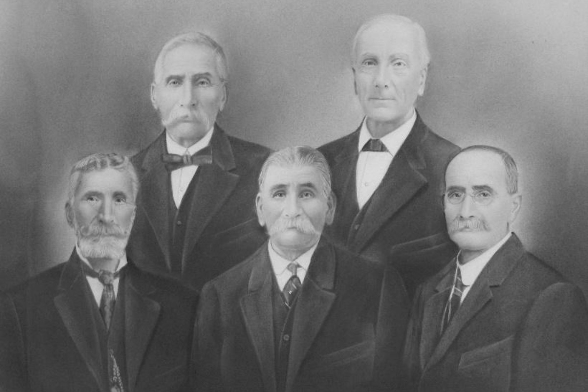
Here is what I know. Nagorno-Karabakh is sandwiched between Armenia, Azerbaijan and Iran. Its name, like its history, is complicated. Nagorny is Russian for “highland.” The word karabakh is a compound word; kara is Turkish for “black,” and bagh is Farsi for “garden.” Nagorno-Karabakh, which literally means Mountainous Black Garden, was the name used during Soviet times and has stuck. I would not know it was called Artsakh, the ancient Armenian name for the region, until Armenian-Australians at the Genocide memorial in Yerevan told me otherwise.
There are many reasons as to the mixed geographies of the Caucasus and Artsakh in particular. Briefly, one reason explains how Stalin, in order to keep local populations from uprising, swapped lands between countries. So even though Nagorno-Karabakh was Armenian, it was administered by Azerbaijan. Another explanation for being part of Azerbaijan was the USSR placating Turkey, which the Soviets hoped would fall within their sphere of influence.
Upon hearing of my trip, one Azeri friend wanted assurances; that I was only going to Armenia and “not to occupied Azeri lands, right?”
He was angry when I told him that part of the appeal of going to Armenia was also visiting Artsakh.
“The Turks took a third of your country,” he said. “The Armenians took a fifth of ours. How can you support them?”
In 1974 after a coup attempting to overthrow the Cypriot government and unite the island with Greece, Turkey invaded under the pretext of saving the Turkish Cypriots. The result was the ethnic division of the island when 250,000 Cypriots were expelled from their homes, with Turkey still occupying the northern portion of the island.
At face value, I could see the parallels between Artsakh and occupied northern Cyprus. In reality, the situations were independent of each other and much more complicated than politicians’ sound bites or tweets.
“But didn’t you visit the Turkish-held north of the island?” I asked my friend. He nodded that he did. “Isn’t that the same thing?” I responded.
I can’t say I blame him when he got up and left.
In the early morning hours, we drove south from Sisian toward the Armenian-Artsakh border. Dotting the winding roads were old women and young boys selling corn on the cob. We passed telephone poles where storks built their nests. Since I speak Greek, I can make out Cyrillic writing, and on the façade of some buildings, I kept seeing one familiar Russian word crop up: мойка [pronounced moika].
“It means car-wash,” said V (my travel partner), who speaks some Russian.
Armenia seemed to be full of these moikas. With so many dusty and rocky roads snaking through the country, there was indeed a market for moikas. In fact, there were moikas all throughout the journey to Artsakh.
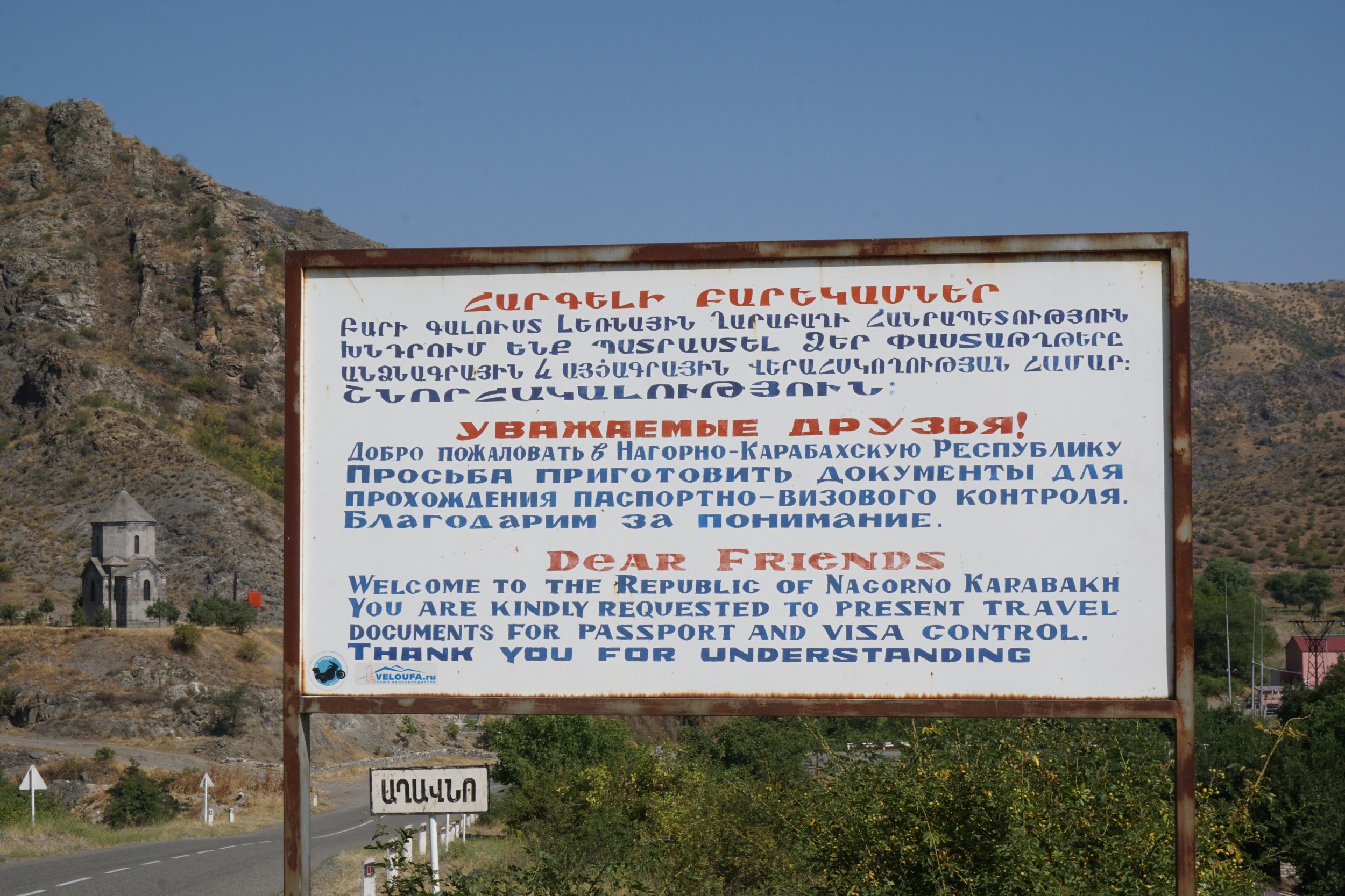
From the great Armenian plateau, we made our way down a steep, winding road. We stopped to take in the view and look down at the border below. At the border crossing, I gave the guard our visas that I got from Yerevan. His superior came out and instructed us to get visas from Stepanakert and then bring the visas back to them when we left the country.
“What? We don’t have time to visit officials in Stepanakert. Our time there is limited. I got our visas in Yerevan already,” I said. “I gave them to you,” and showed the guards my phone which had photos of our NKR visas. I spotted the visas on his desk, and I pointed to them. They waved us through.
I thought Armenia had a rugged landscape, but that was until I had crossed over into Artsakh. The roads dipped and shifted according to the character of the mountain. Before I knew it, we had driven past a large stationary tank; the first to enter Shushi.
I liked Shushi. The city had a good energy and was enjoyable to explore. I noticed people observing me. I must have seemed nosy, scribbling notes in my diary and manically taking photos. Since I have darker features, most people mistook me for Armenian and allowed me to get on with whatever I was up to, thereby not rousing too much suspicion.
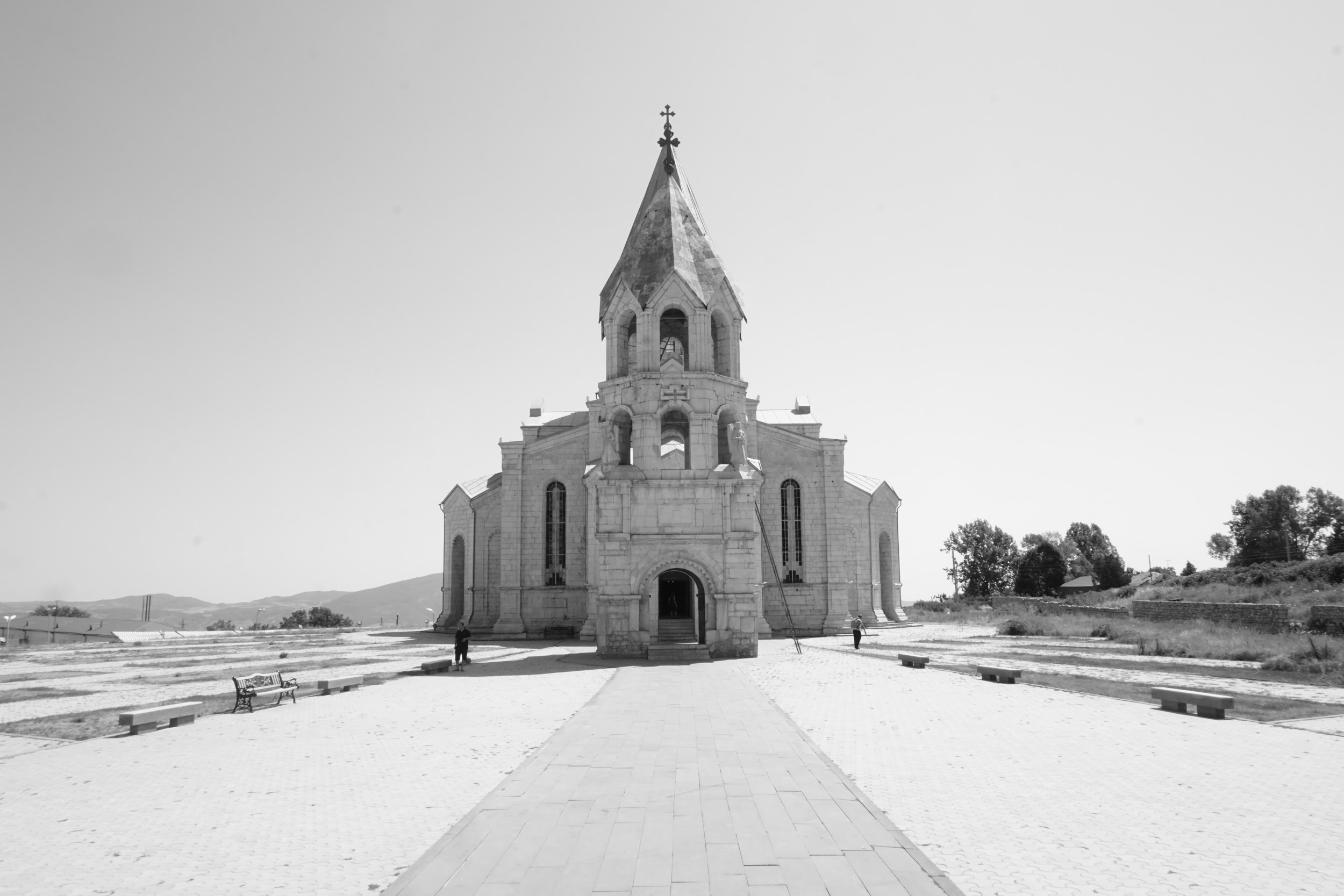
I always enjoyed visiting places of worship, regardless of its faith, so I was pleased to discover Ghazanchetsots Cathedral across the street from rows of Soviet apartment blocks. The Cathedral served as an armoury during the war. Now newly rebuilt, its white tiles sparkled under the summer sun.
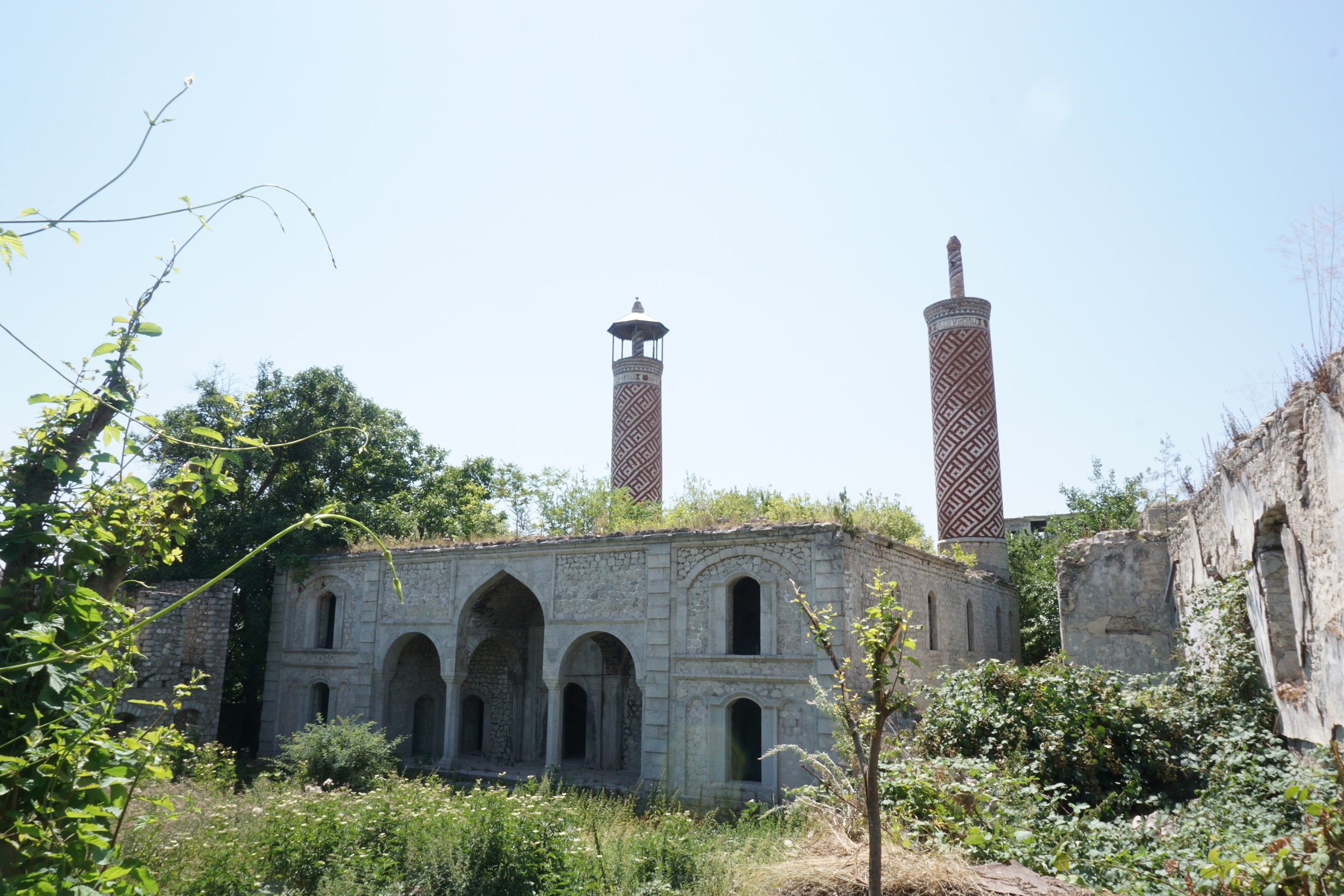
I went looking for the Ashaghi Govhar Agha Mosque, located in Shushi’s lower town. During my search, I came across a new, Iranian-funded mosque. I walked along a backstreet and came to what seemed like a garden. I pulled the overgrown brambles back to find a stunning abandoned building with a pair of crumbling red and white minarets. I could not help but wonder why a new smaller mosque was being constructed when such a masterpiece of Islamic architecture was left falling to pieces. They don’t make buildings like that anymore. Couldn’t the building at least be preserved for its beauty?
It was midday when we arrived in Stepanakert, and the August sun was beating down on us. One gentleman, who thought we looked lost and bewildered, was friendly enough to stop and ask if we needed directions. We didn’t. We were happy to wander. We saw the National Assembly with its roof in the design of an Armenian church. Pedestrian streets were flanked with lampshades. At a lineup of taxis in Renaissance Square, I noticed one of the signs was spelled ‘taksi,’ which was the Azeri spelling of the word. All other taxis were spelled as ‘taxi’. Was ‘taksi’ a throwback to a time before the war?
Even if the buildings were old, even if they were not in the best condition, Stepanakert was spotless. As we were walking along Azatamartikneri [Freedom Fighter] Street, we did not see a single wrapper tossed in the street. It was clear the people of Artsakh were proud of their roads, as they are their only link to Armenia.
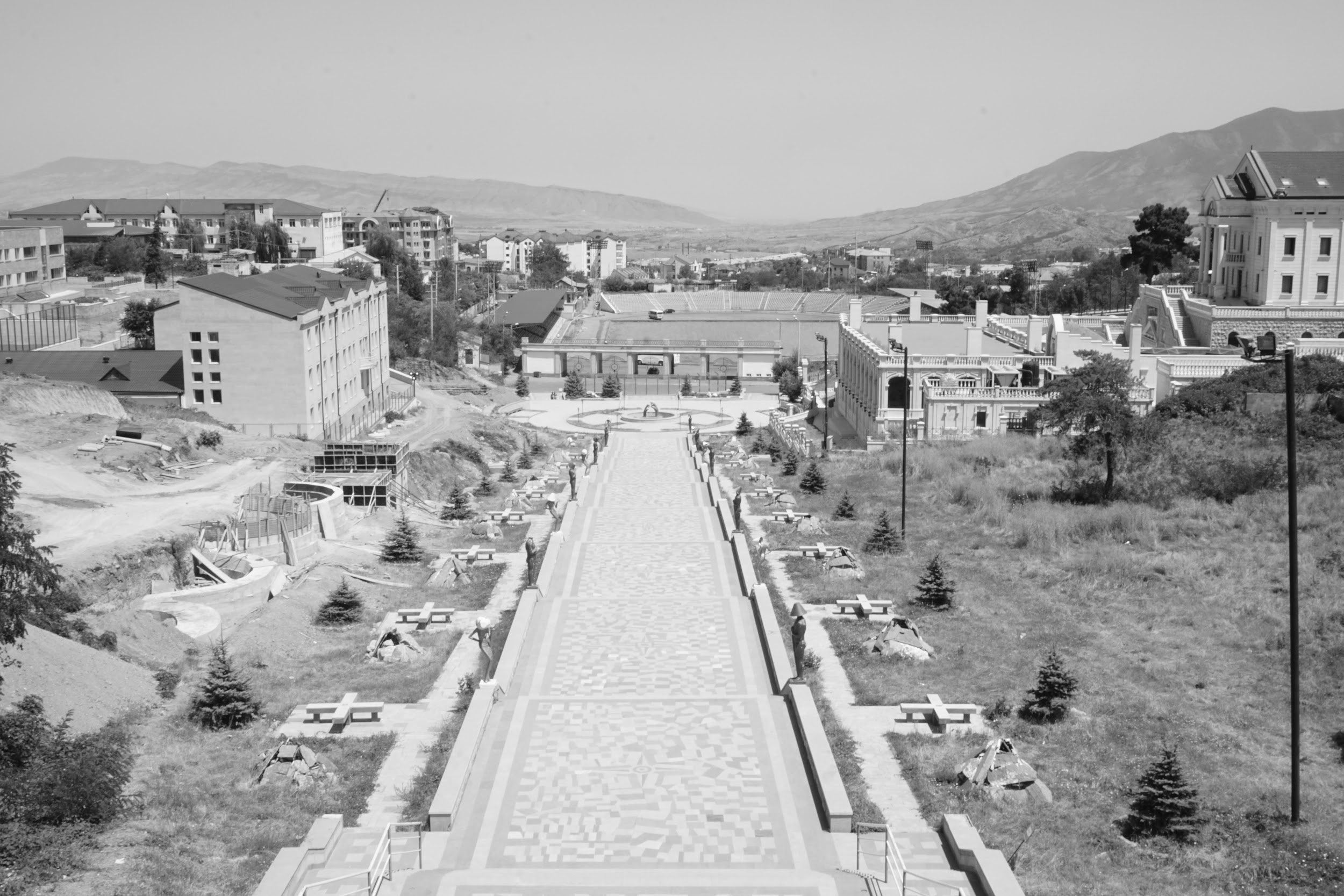
We stopped at Artsakh’s most famous landmark—the ‘We Are Our Mountains’ statue. That’s where I bought several rare NKR stamps. Then we had lunch at Hotel Armenia to prepare our stomachs for the journey to Dadivank.
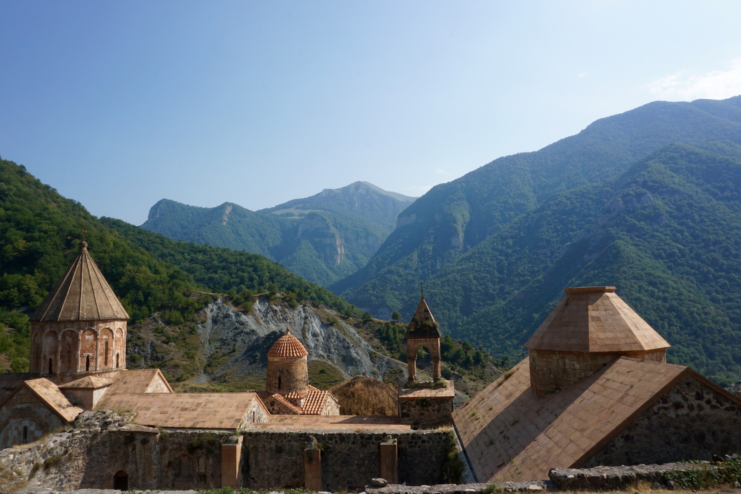
And what a journey it was. The road was under construction. It took us 2 hours to travel 90 kilometers. Wow, was it worth it. Dadivank Monastery was nestled amid a mountain range of endless greenery under the bluest of skies. Workers were busy reconstructing the Monastery, as we explored the ancient site and admired the mountains that touched the sky.
I have so much more to share about my visit, but my travel diary concludes here.
Sometimes, foreigners notice things about our countries that we locals may miss. In writing this piece, I hope I did Armenia some justice.
Oh… and shnorhakalutyun.
Azerbaijan is a 20th century invention. It never existed in the history of the region. It was artificially created on occupied Armenian lands a hundred years ago for the former homeless Caucasian Muslim Tatars by genocidal Central Asian Ottoman Turks and the Soviet criminals as a Turkish outpost in the South Caucasus for pan-Turkic agenda and as a base for Soviet expansion into Persia and the Middle East. The pan-Turkic agenda has always been the destruction and the elimination of Armenia off the map in order to establish the so-called mythical Land of Turan under Islamic banner which called for the unification of all Turkic peoples from the Balkans to China at the expense of the indigenous Christian populations of the lands non-native and genocidal Central Asian Turks had under their occupation for centuries.
There has never been a nation in history called Azerbaijanis. This name was stolen from the Persians and given to Caucasian Tatars (Turkified Mongols) today occupying native Armenian lands. Armenians are NOT occupying anyone’s lands. The so-called Azerbaijanis never had any land or a country to occupy. They are the ones occupying other people’s lands. The entire region from Kur River to Araxis River belongs to native Armenians. All territories liberated in 1994 are part of Armenia and there is more territory to be liberated, the ancient Armenian province of Nakh-Ijevan (Armenian and Biblical for: The original resting place of Noah) in particular. Additionally, there are six Armenian provinces in today’s eastern Turkey, occupied Western Armenia, still under the occupation of genocidal Turkey. The Armenian Genocide of 1915 in which 1,500,000 native Armenians were murdered by the Turks was a means to confiscate permanently a major part of the ancient Armenian homeland (90% of total Armenian landmass) for the Turks only but without the Armenians.
Furthermore, the only place in the region that remotely comes close to Azerbaijan in name is Atropatan which is located in today’s Islamic republic of Iran to the south of the Araxis River (Iran-Armenia border) WHILE the artificial Azerbaijan republic was invented on territory to the north of the Araxis River which has always been Armenian. It is long overdue that delusional and institutionally-brainwashed Azerbaijanis face the truth and stop spewing nonsense about the indigenous Armenians!